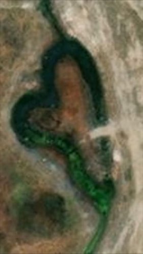
February 17, 2023
One last heart/love in honor of Valentine's day! Water cuts all kind of interesting patterns and wit...
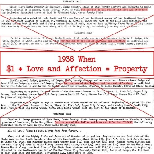
February 16, 2023
Thrusday throwback to 1938 when love and affection was included on warranty deeds. In honor of Valen...

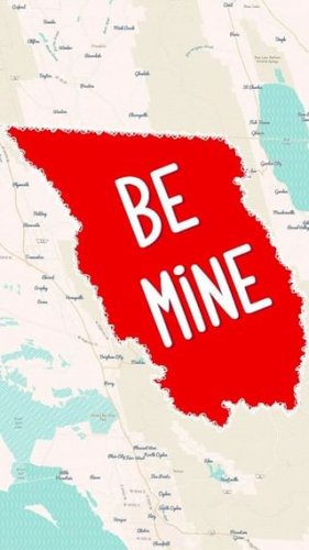
February 15, 2023
Have you noticed the Parcel pop-up looking different? In January, our IT department freezes the tax ...
February 14, 2023
Happy Valentine's day!! This map is shown in the Bonne projection. This projection has been around t...

February 10, 2023
We try to align and update our data as much as we can. The historical block and lot data is very rou...
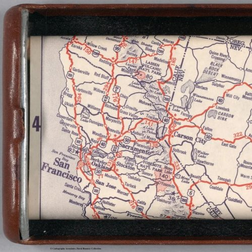
February 09, 2023
Before the days of waze and Google maps this handy dandy map would guide you on a road trip. This ro...
February 08, 2023
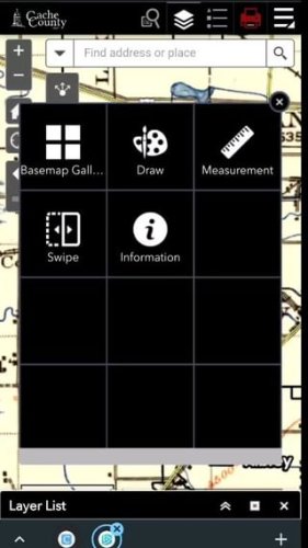
Have you used the swipe widget yet? It is definitely one of our favorites!
February 02, 2023
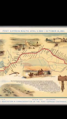
David Rumsey has a ton of beautiful maps! This illustrated map of the Pony Express is informational ...
January 31, 2023
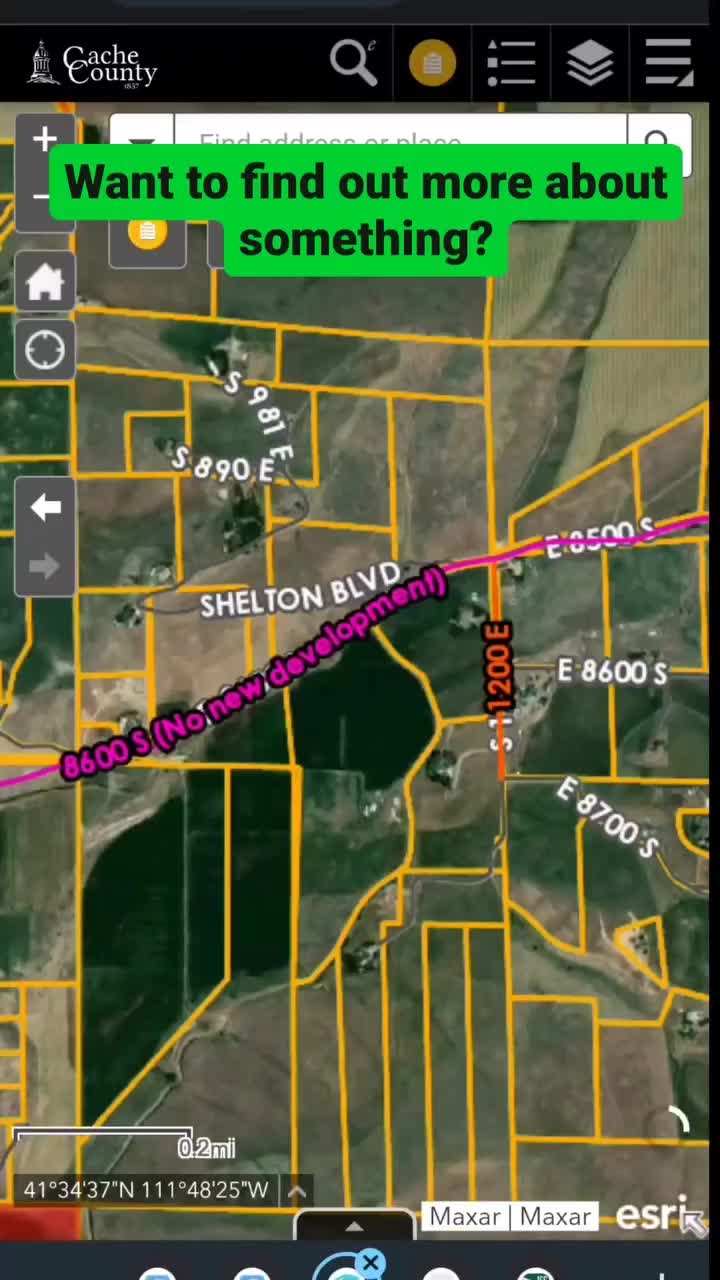
Just like clicking a parcel to see much more info, this works with other layers. The example here hi...
January 30, 2023
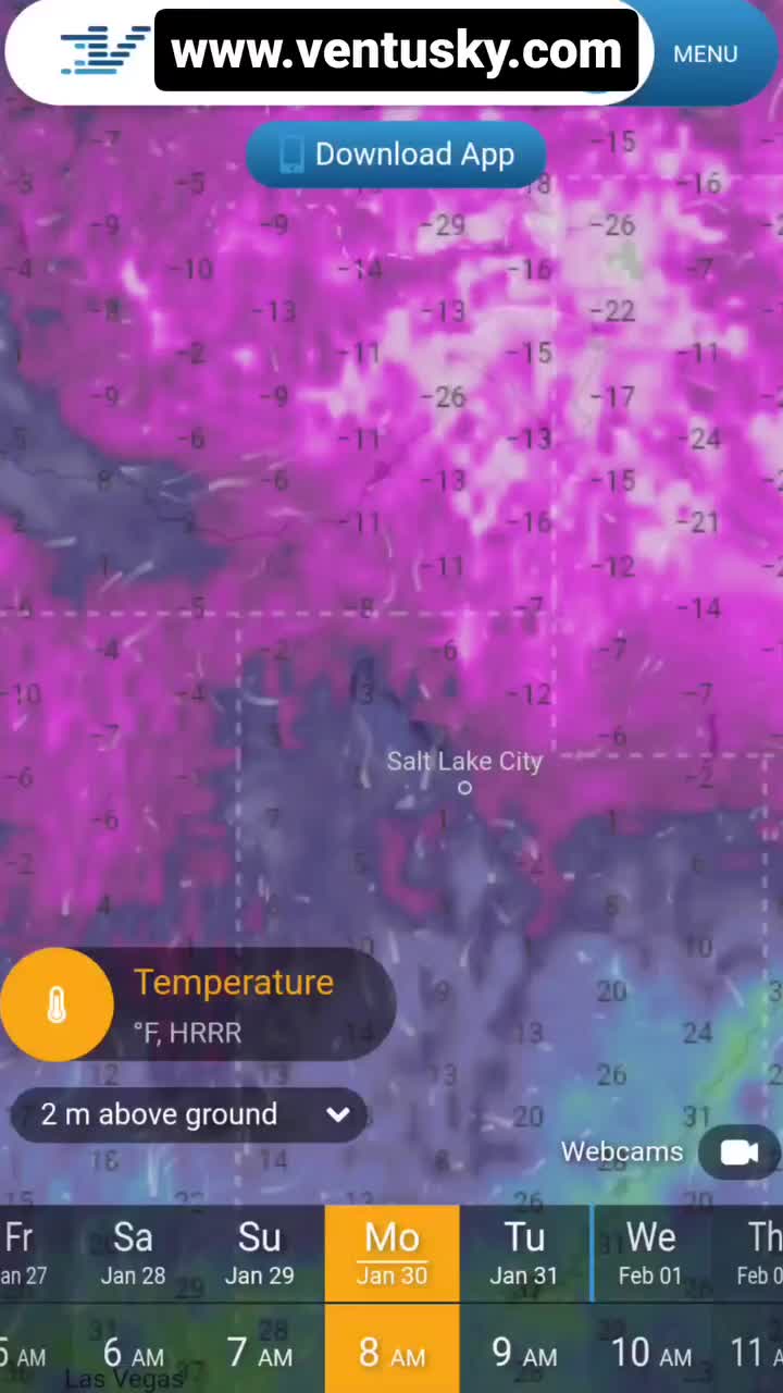
Cache County is chilly this morning! This map from Ventusky is an awesome visual of how cold it is i...
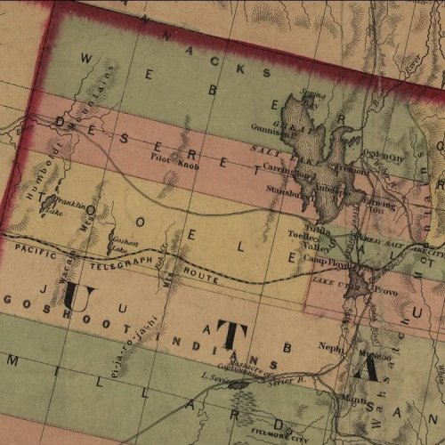
January 26, 2023
In 1860 congress passed the Pacific Telegraph Act, which provided money for completion of a telegrap...

January 25, 2023
We talk about widgets a lot. But what is a widget? It's just a fancy name for tools or processes tha...

January 24, 2023
Does Cache County have GIS data for utilities?
We get this question from students, consultant's, al...

January 23, 2023
Have you looked through our Cache Valley Past to Present interactive map? There are so many cool pic...

January 20, 2023
It's finally Friday! Remember, GIS data is only representational. We love that people find out stuff...