
June 17, 2022
Fun fact Friday! Did you know there are 336,338 acres of private land that is classified as greenbel...
June 16, 2022
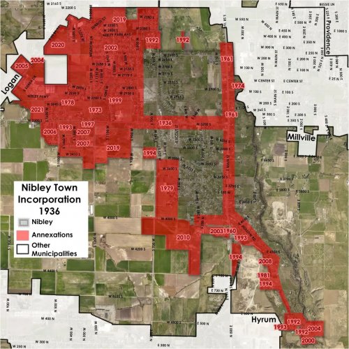
Did you know Nibley was incorporated because of water pipelines? The Millville Public Works Company ...
June 10, 2022
It's finally Friday! Enjoy some fun facts about our GIS data and history.
#cachecounty #cachecountygis
June 09, 2022
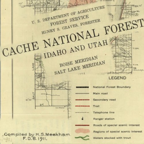
Cache Valley has changed a little since 1911 when this Forest Service map was done. Check out the fu...
June 08, 2022
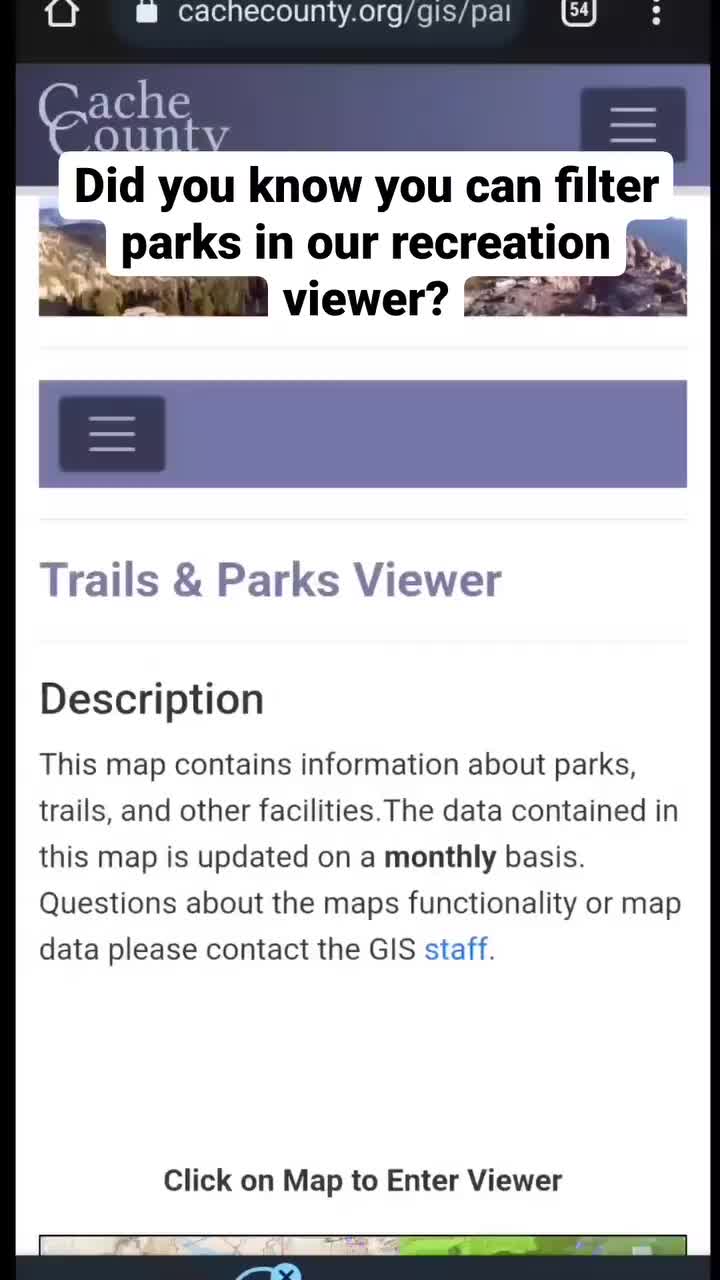
Did you know our recreation viewer has a widget that can filter parks by amenities? This example sho...

June 07, 2022
We provide some of our data directly for download on our web page. For a more complete set of the da...
June 06, 2022
Hopefully all the maps we provide make your research, curiosity, or jobs easier!
#cachecounty #cach...
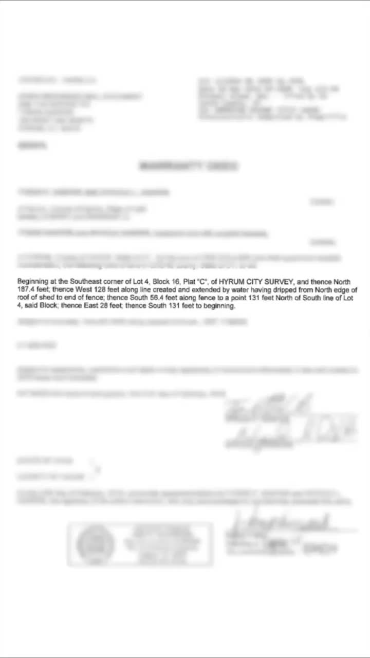
June 03, 2022
Legal descriptions in the county are not all created equally. We do our best to represent the legal ...
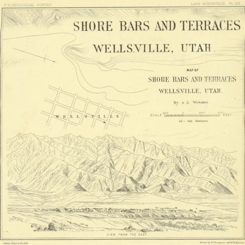
June 02, 2022
Throwback to another beautifully drawn map from 1890. This one was created as part of the USGS study...
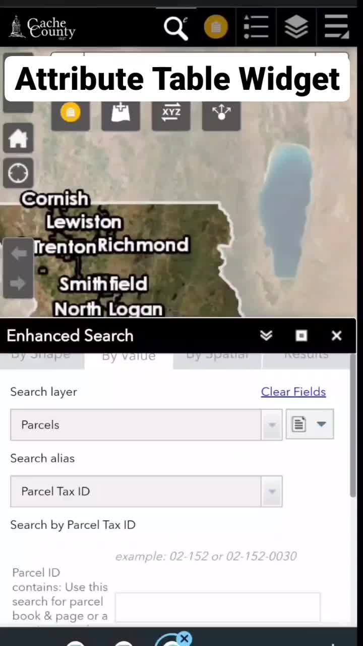
June 01, 2022
The attribute table widget hangs out at the bottom of most of our maps. Expanding it shows all the d...
May 31, 2022
Curious about where out data comes from? Under our FAQ page we have a document with links about the ...
May 26, 2022
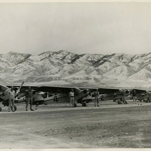
Logan Cache airport has grown a lot since 1933. The airport had humble beginnings with barnstormers,...

May 25, 2022
Did you know the mailing list creator widget can buffer multiple parcels? Use the plus button to buf...

May 23, 2022
Looking for a USGS topographical map? Check out the U.S. Geological Survey's topoView. This webviewe...
May 20, 2022
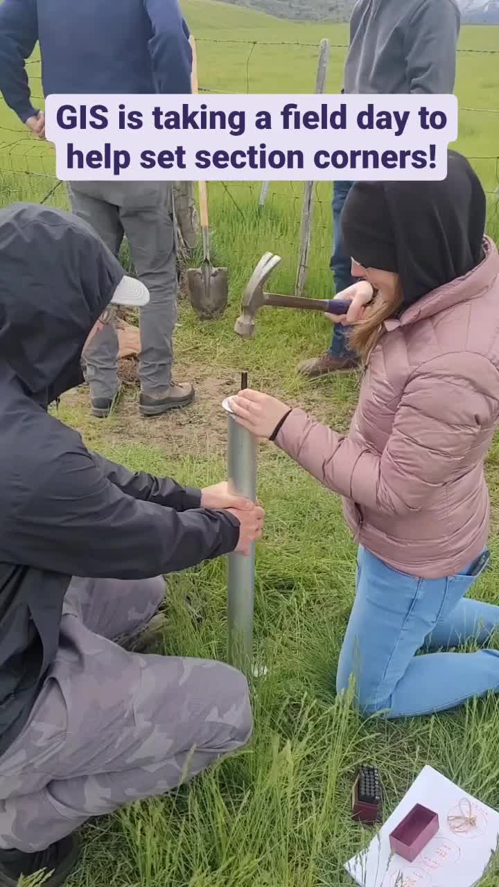
Section corners help tie our data to the ground. Today we are having a fun Friday and seeing how the...