October 06, 2022
This county has seen a lot of logos over the years. Which one is your favorite?
#cachecounty #cachec...
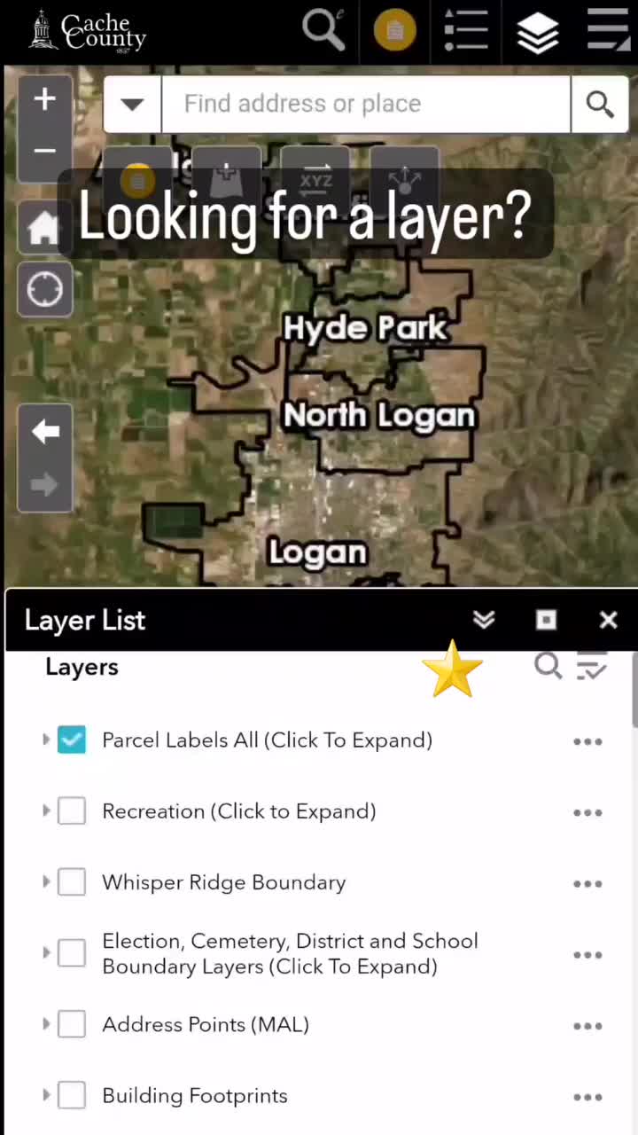
October 05, 2022
Finding a layer in our web maps can take some time. The search in the layer list widget can make qui...
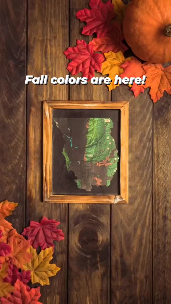
October 03, 2022
Have you noticed the leaves changing? The hills are alive oranges, red and yellows! It's a great tim...
September 30, 2022
GIS is a representation of the all these great recorders. The bottom started when surveyors first la...
September 28, 2022
Have you clicked a parcel and the pop-up was almost blank? When the Recorder's office processes your...

September 27, 2022
Did you know the Canal and service area map has not only the name of the canal but also a board memb...

September 26, 2022
The Cache County Public Works department has worked for years to keep paved County roads black. The ...
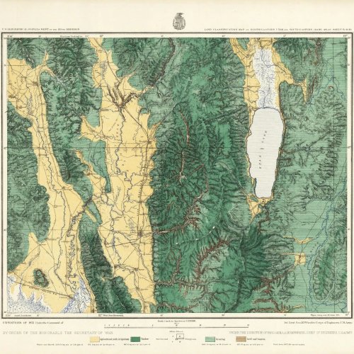
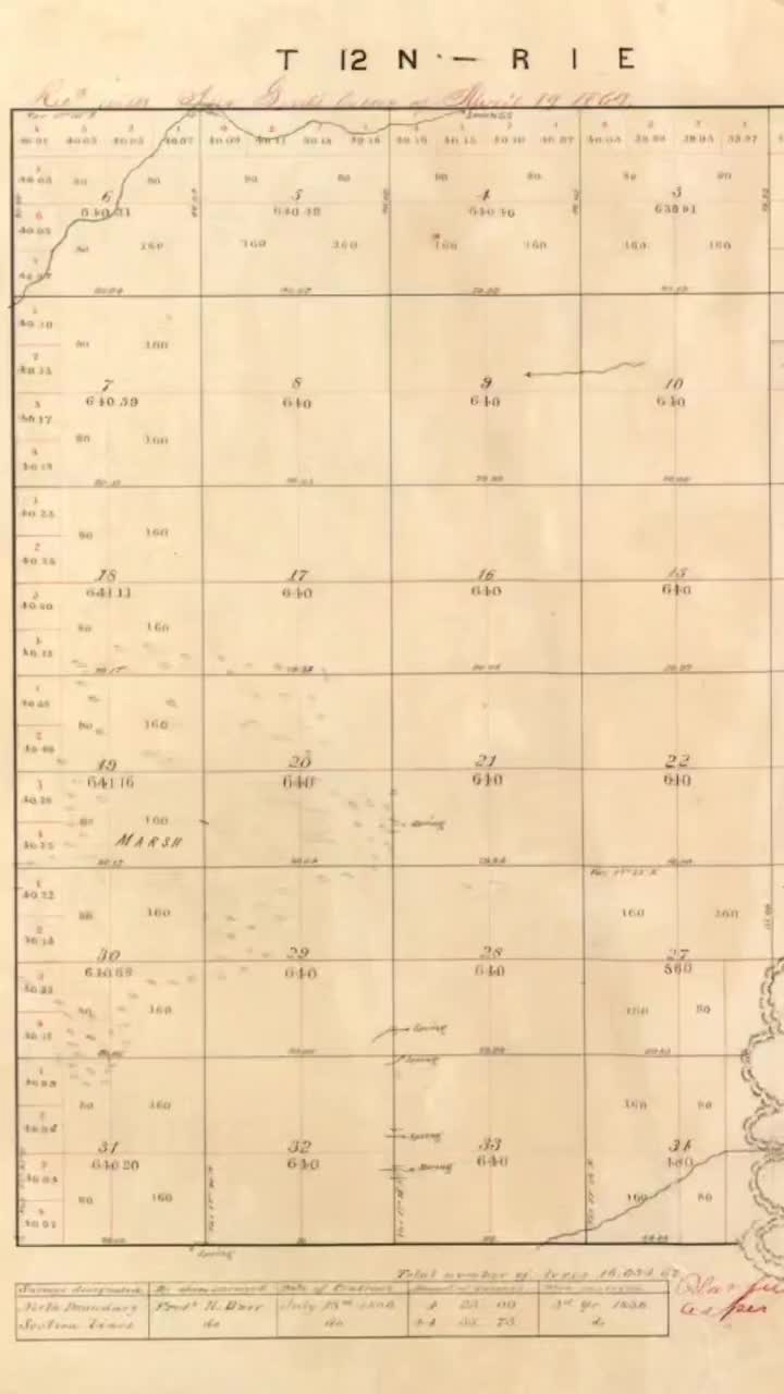
September 22, 2022
This historical map comes from the David Rumsey Map Collection. They have a ton of beautiful maps! T...
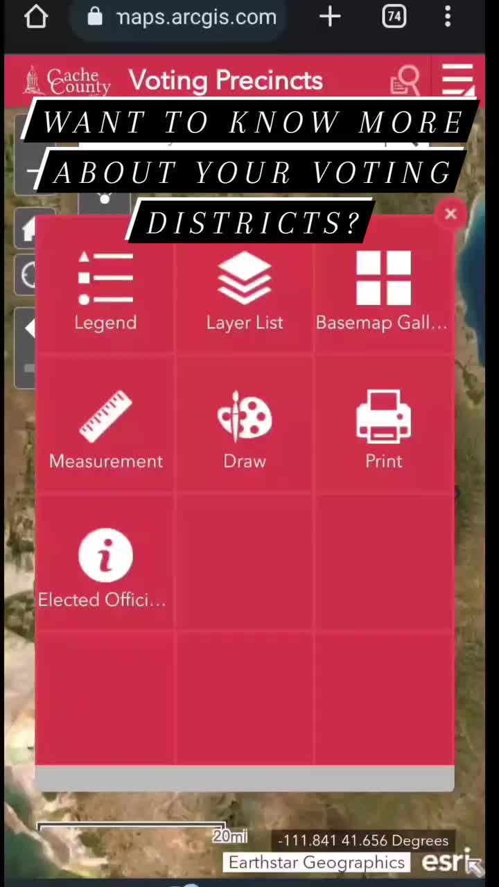
September 21, 2022
Voting time is coming soon! You have probably seen all kinds of signs around but which ones do you v...
September 20, 2022
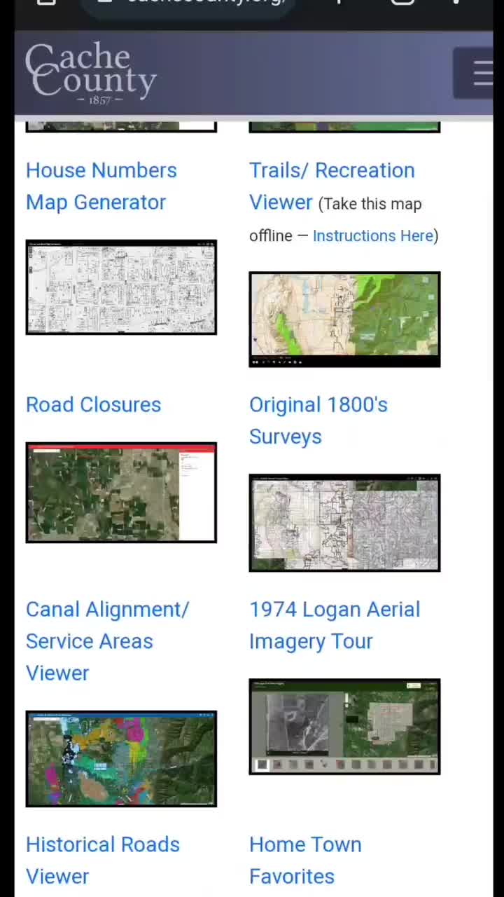
4 seconds is not enough time to throw out all the things we do in GIS but these are our top projects...
September 19, 2022
Have you used our house number generator map? We lovingly call it the paper boy map but it could be ...
September 14, 2022
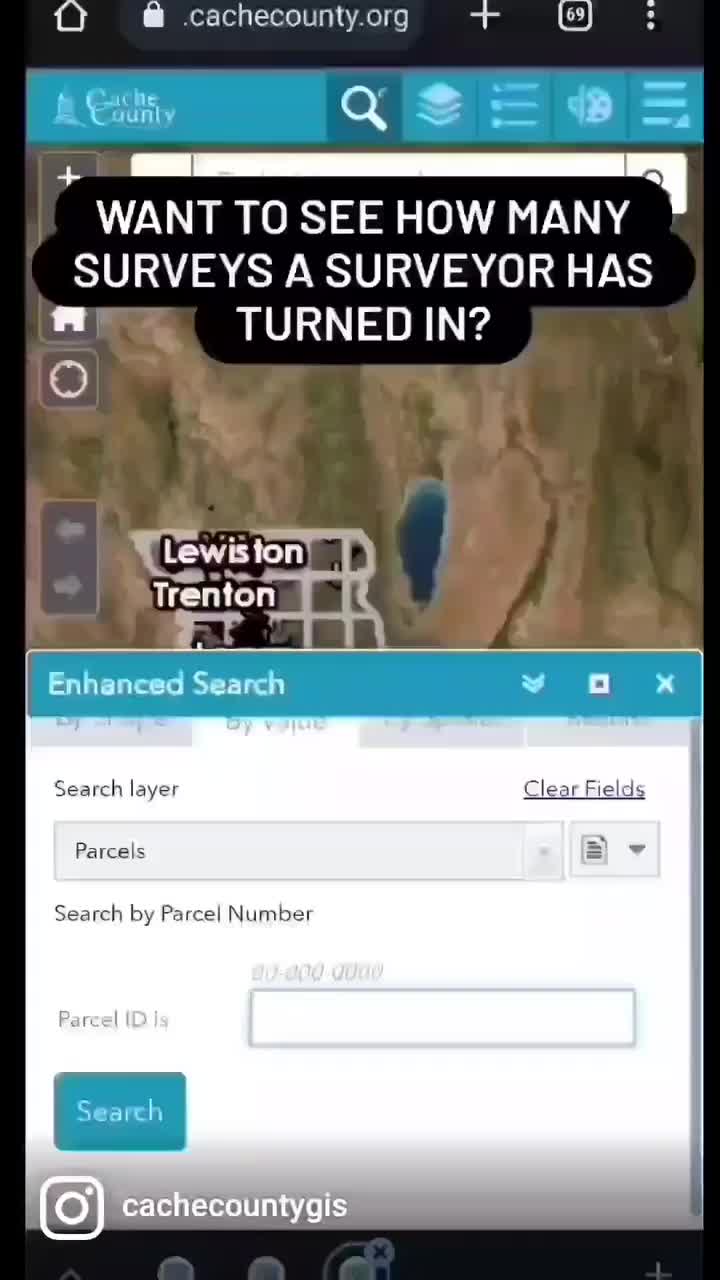
There have been many surveyors that have worked in Cache County over the last 165 years. If you want...
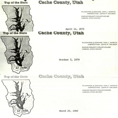
September 08, 2022
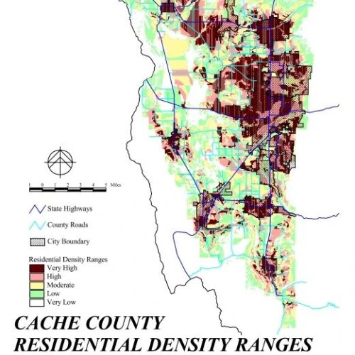
Back in 1998 the County adopted a comprehensive plan. This was to gauge where things where at and ma...
September 07, 2022
Our web viewers can take some time to load. There is a lot of data trying to reach you. Some of our ...
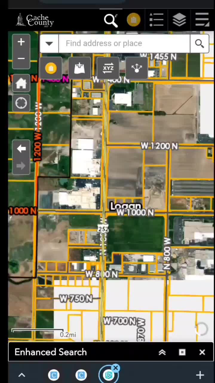
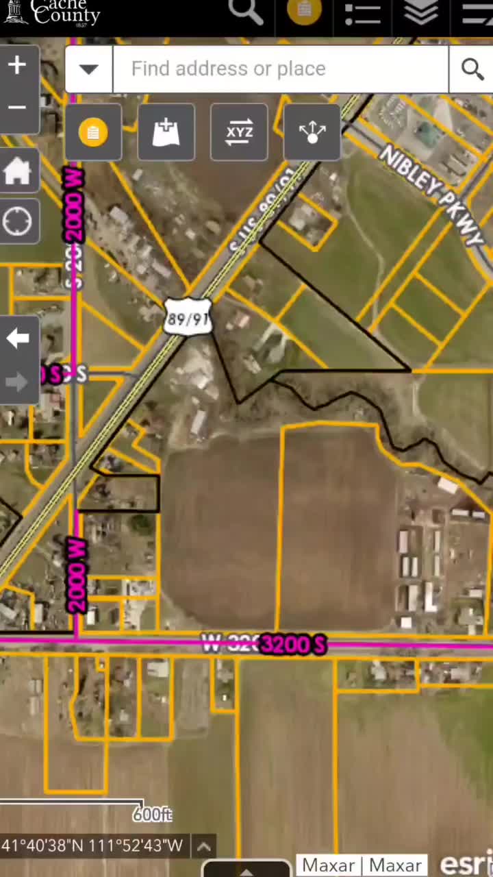
September 06, 2022
Big announcement! Some of you may have already noticed but, 2022 imagery is here! Use the layer list...