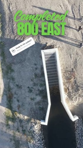
September 22, 2025
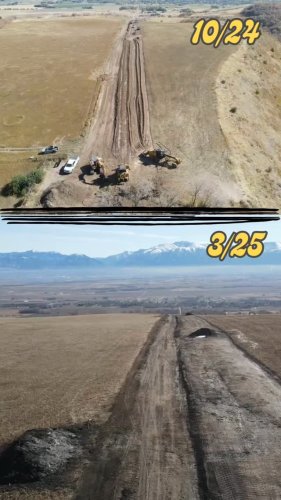
800 East near Avon is looking great and the repairs this summer!
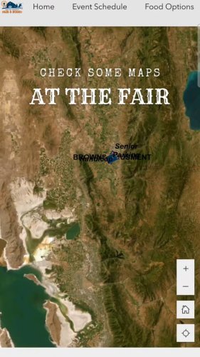
August 08, 2025
While you're at the Fair checking out exhibits in the event center please stop by and check up the f...

August 07, 2025
Tonight in conjunction with the Fair and Rodeo is Ignite the Light! To raise awareness wear turquois...

August 05, 2025
Its the best time of the year, FAIR WEEEK! The fun has started and its only going to get better. Use...
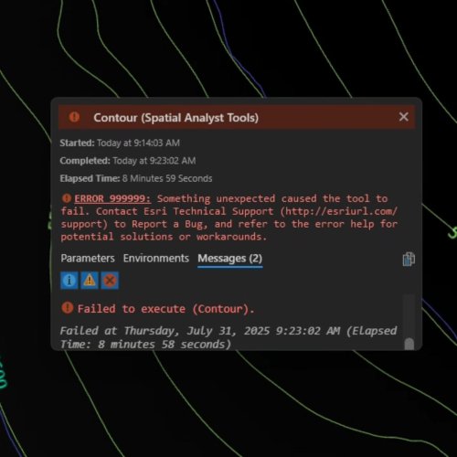
July 31, 2025
Thanks for taking almost 9 minutes to fail. 9 minutes of hopes and dreams dashed for an error with n...

July 16, 2025
When pins are so popular that people follow you around the San Diego conference center and clap afte...
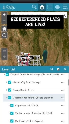
June 09, 2025
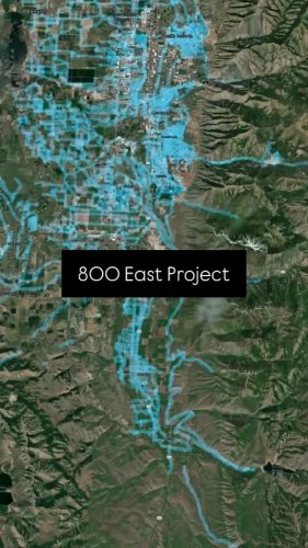
Coming to your favorite Cache County web map is georeferenced original town and patent plats! Expand...
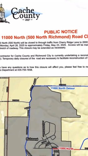
April 29, 2025
Cache County and Richmond City are reconstructing 11000 N (500 N). This means road closures and deto...
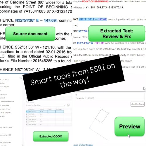
April 22, 2025
Part of the ArcGIS Pro 3.5 release looks awesome! The Parcel Fabric will have a built-in COGO reader...
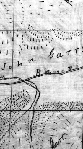
April 17, 2025
Another old survey with no location information from another Garr family member. This map shows John...
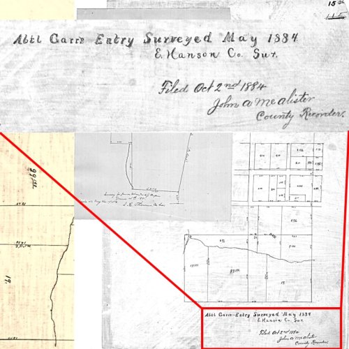
April 10, 2025
Some old maps forgot things we consider basic. Like a township, range section, or even town. To figu...
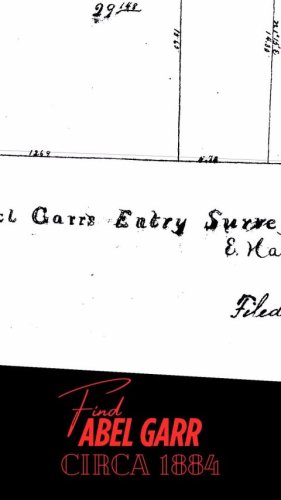
April 10, 2025
Some old maps forgot things we consider basic. Like a township, range section, or even town. To figu...
April 07, 2025
Another public works project is in progress to improve the safety of a county road. 800 East near Av...
April 03, 2025
We understand math is hard. But how did the west side of Smithfield go from nice grid streets to bei...
March 31, 2025
Last week, we checked out the progress public works has been making in Deep Canyon. The difference 5...